
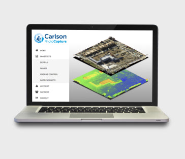
OVERVIEW
Aerial surveying and drone photogrammetry is rapidly becoming a vital part of any surveyor’s toolkit. Thousands of people use drone site flyovers every day to help boost efficiency and lower costs.
With Carlson PhotoCapture drone photo processing software, you can use flyover data to:
• Quickly generate interactive 3D maps of sites
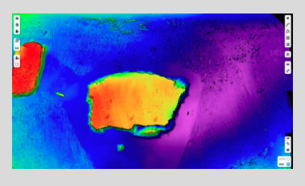
• Capture highly accurate 3D site data in point clouds, orthophotos, and more
• Integrate LiDAR data from aerial or ground sources into photogrammetry projects
• Share site maps with customers – anywhere, anytime!
• Save man-hours in the field
PROJECT CREATION
- Polygon Selection/Removal of unwanted images with a click of a button
- Project Splitting with Polygon Selection Tool (Large project into small projects)
- Visualize project area before processing
- Ground Control Point (GCP) import (landxml,.csv, .txt)
- Manual Ground Control Point input
- Ground Control Point Validation
- Metric, Feet, and US Survey Feet support
- Global/Local Coordinate System Support (thousands of supported projections)
PROJECT PROCESSING
- Nadir/Oblique Support
- Self-Calibration – Automatic Determination of Camera IOP and EOP
- Fixed-Calibration – Use your own calibration parameters for processing
- Automated Bundle Adjustment
- Automated Point Cloud Densification
- Automated DEM Generation
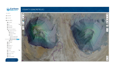
- Automatic Contour Generation
- Automatic Mesh Generation
- Automaic Orthomosaic Generation
- Accuracy Report
PROJECT OUTPUTS
- Orthomosaics in GeoTIFF, jpg, png output format
- DEM in Geotiff, jpg, png output formats
- 3D point cloud in .las, .xyz, and .ply
- 3D mesh in .ply, .obj, and .glb formats
- Contours in .dxf, GeoTIFF formats
- Accuracy Report in PDF format
- In-Browser Volume Calculations
COLLABORATION
- Web visualization of all data products
- Visualize 2D maps and 3D models using any web browser
- Cesium 3D Tile Integration
- Instant measurement of distances and surfaces
- Share Projects with annotations via a simple link
- Embed project output in a webpage
- Visualize Site Changes over Time in 2D and 3D with Project Timeline
